


 54 / 164

54 Independence Group NL
Rocklands
Victoria
Eildon
Makoan
Cairn
Curran
Reeve
King
Manapouri Sth
Waranga
Albacutya
Taupo Sth
Windermere
Dartmouth
Tekapo
Du Faur
7,600,000 mN
7,500,000 mN
500,000 mE
600,000 mE
500,000 mE
600,000 mE
7,600,000 mN
7,500,000 mN
NT / WAState Boundary
700,000 mE
700,000 mE
0
25
kilometres
MGA Zone 52 (GDA94)
Prospect
Granted Tenements
Application Tenements
100
0
Au percentile
N
0 250
kilometres
Darwin
Alice
Springs
NT
Lake Mackay JV
Location Map
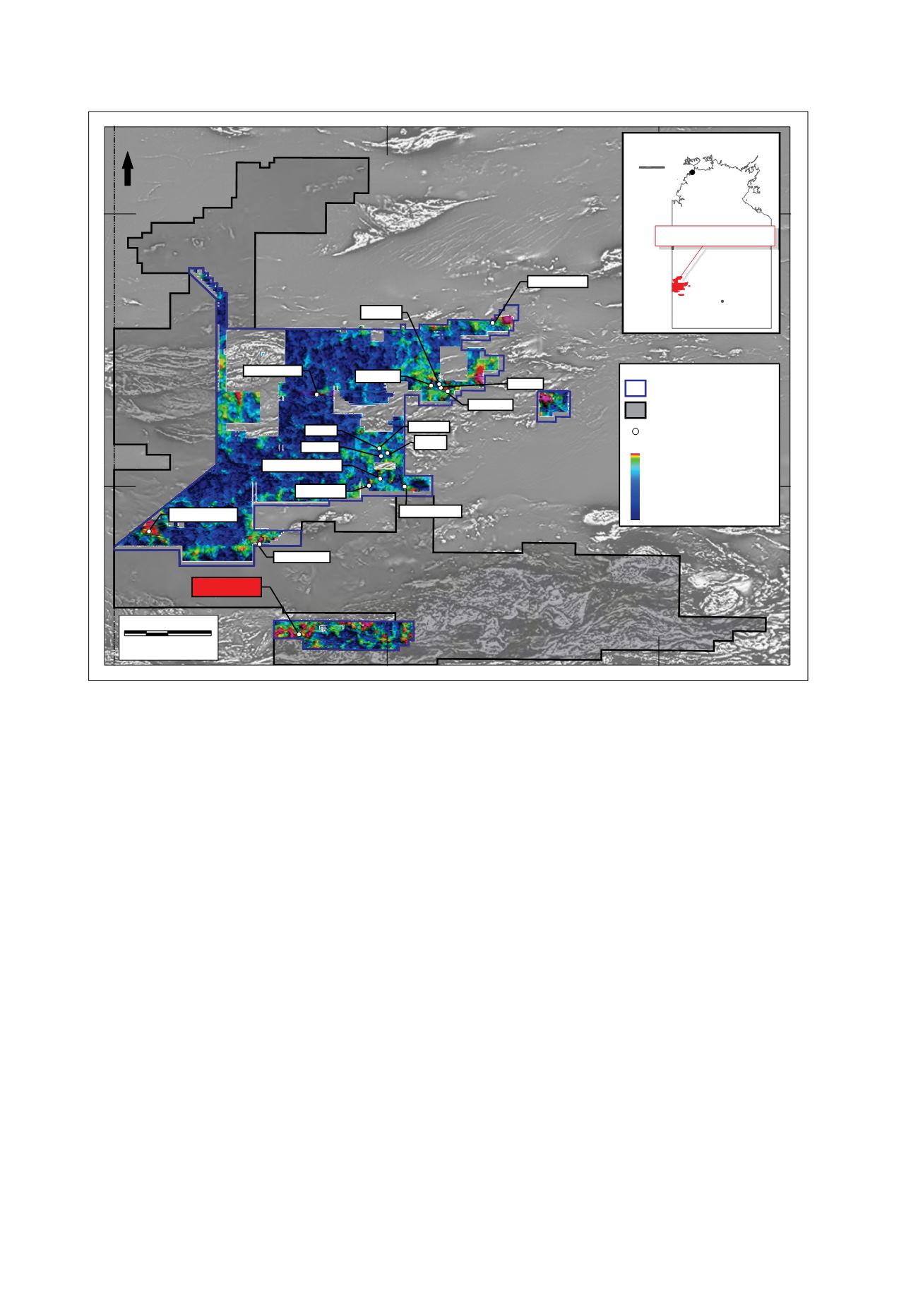
Figure 23: Lake Mackay tenure with aeromagnetic underlay
Lake Mackay Exploration Alliance (IGO has potential to earn up to 70%)
IGO has an exploration alliance with ABM Resources NL (ASX: ABU) under which it can earn a 70% interest in a portfolio of
tenements in the Lake Mackay region in the Northern Territory.
The Lake Mackay Project is located 400km northwest of Alice Springs, adjacent to the Western Australian border, and includes
7,200km
2
of exploration licences and 12,130 km
2
of exploration licence applications, including recent applications in the Du Faur
area. The area includes sparsely explored Proterozoic age metasediments intruded by granitic and mafic rocks beneath varying
thickness of aeolian sand cover and is considered prospective for gold, base metals and nickel sulphide mineralisation.
The exploration approach is to initially blanket the project area with systematic high quality, low detection limit surface sampling
to identify the geochemical signature potentially caused by large mineralised systems beneath shallow cover. During FY2015, IGO
collected 5,128 first pass reconnaissance samples and 3,505 infill samples, which together with sampling undertaken in FY2014,
completes the geochemical coverage of the project area.
In the December 2014 quarter, 15 low-level surface sample geochemical anomalies were tested by an AC drilling program
comprising 145 holes for 12,277m. The strongest results from this program came from the Tekapo Prospect and included
intercepts of 8m @ 1.57g/t Au, 22m @ 0.25g/t Au and 16m @ 0.48% copper in 14LMAC058.
Surface sampling in the March 2015 quarter, on EL24915 identified an area of nickel-cobalt anomalism on the margins of a
large gabbro-noritic intrusive body. Rock chip samples returned up to 1.60% nickel, 1.61% cobalt and 38.5% manganese from
a lateritic outcrop while nearby soil sampling produced a 7km x 5km nickel-in-soil anomaly with peak value of 1,300 parts per
million. Gabbro-norites are prospective for magmatic nickel-copper sulphide mineralisation and this potential is currently being
evaluated.
Late in the June 2015 quarter, an AC program comprising approximately 100 holes (8,000m) commenced in the southern part of
the project testing six gold and multi-element surface sample anomalies located on EL24915 and one gold target (Windermere
South) located on EL27780.